About : REM History


Early research in digital mapping


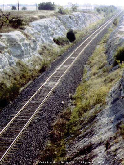
Middle: View from above
Bottom: View from below
Many pioneering efforts in technology have resulted in the establishment of companies that are designed to offer solutions to complex problems. Such was the case with Real Earth Models, LLC (REM), founded by Ms. Bobbie Neubert.
Already well established in management of oil and gas investments, as well as other enterprises, Ms. Neubert endeavored to broaden her knowledge of oil and gas through graduate studies at The University of Texas at Dallas (UTD). Much of her research was devoted to studies in GIS, through which she learned advanced techniques for mapping wellhead locations. She readily recognized the association of GIS and GPS with laser scanning and 3D modeling. Intrigued with the potential of long range, fast scanners for producing valuable data, she purchased two laser scanners, software, and other necessary equipment to further her investigation of laser scanning technology.
Ms. Neubert’s active involvement in the study and application of this technology, led her to Dr. Xueming Xu, a gifted computer scientist and researcher. Dr. Xu was, at that time, developing the algorithms and programming that form the basis of the 3D PhotoReal™ Model. For his keen insight and innovative work creating the 3D PhotoReal™ Model, Dr. Xu’s technological development received United States patent protection.
§ § §
Working in collaboration, Dr. Xu and Ms. Neubert set out to prove the success of PhotoReal™ technology through numerous national and international test projects. These projects laid the groundwork in establishing the reliability and the essential role of PhotoReal™ modeling technology in serving private and commercial interests. In 2002, Ms. Neubert was convinced that PhotoReal™ modeling technology could supply the needed missing visualization data to promote progress in business and industry. She founded Real Earth Models, LLC in April of that year. Thus began REM’s expansion of real world visualization into the 3D arena through its services and products in laser scanning, mapping and PhotoReal™ modeling.
During REM’s first three years of operation, Ms. Neubert and Dr. Xu carried out numerous projects in PhotoReal™ modeling, primarily in research and development. The repeated success of their projects in research led to increased demands for commercial production. In January 2006, Dr. Xu, who was instrumental in founding REM, formally joined the firm, leading REM’s research and development. That year marked the completion of three significant projects at REM, thus further establishing the practical utility of the PhotoReal™ modeling concept, and confirming REM's ability to deliver an accurate product with proven value in solving problems for various industries.
§ § §
Today, REM’s precise visualization technology remains in a class of its own. Although other companies offer laser scanning services, only REM empowers laser scanning technology with a technique that provides precise information that is at once quantitative and qualitative. REM’s PhotoReal™ technology provides the most accurate illustration of data and is a proven solution to the informational gap found in conventional scanning methods. REM’s services have supported applications in business, government services, research, corporations, universities, private organizations, and individual clients.
The future will bring even more innovative use of PhotoReal™ modeling technology with continued development of virtual museums and staging for caves. Real Earth Models, LLC remains at the forefront in powerfully redefining precise visualization.
§ § §
Home | About | Consulting / Services | Portfolio | Site Map
web site ©copyright 2012 - 2025 Real Earth Models, LLC
Problems viewing this web site?
