About REM :


Real Earth Models, LLC (REM) is a full-service consulting firm that specializes in providing precision 3D visualization technology to businesses, industries, governmental and educational institutions, organizations, and individuals worldwide.
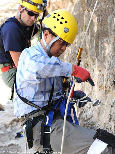
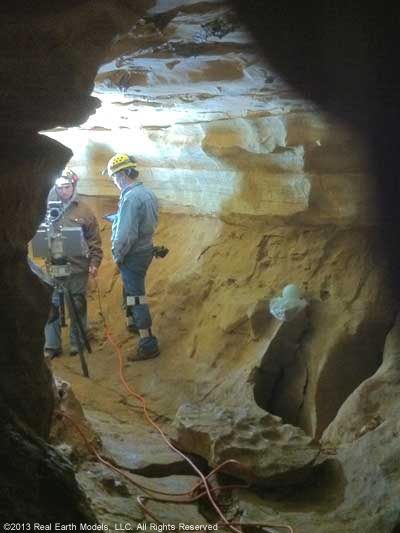
Our services in 3D laser scanning, mapping, and modeling are performed by experienced professionals using the latest cutting-edge equipment. Our methodologies were developed to deliver a higher standard of excellence in precision 3D visualization.
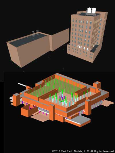
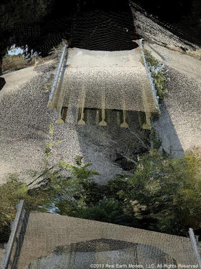
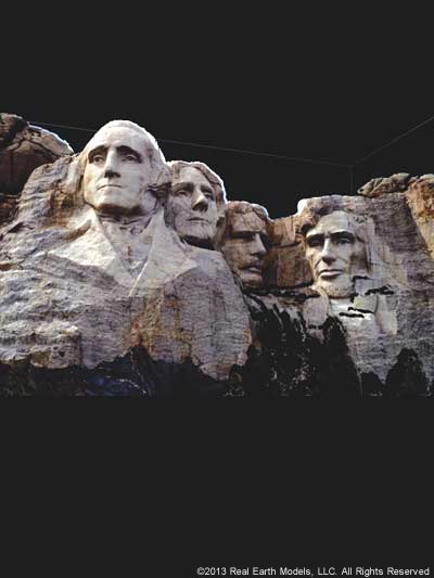
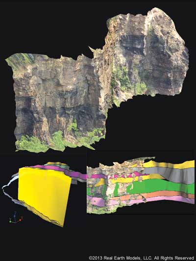
Where accuracy in laser-scanned documentation is vital, our proprietary technology, the 3-D, PhotoReal™ Model, exceeds basic modeling and measurement information. Our unique processing capability captures all aspects of texture, volume, light, and color in an exact representation of the original. Viewing accuracy is maintained at every angle, without distortion. Our PhotoReal™ modeling technology is based on a careful fusion of 3D laser and photographic data that enables the viewer to see what the eye cannot, while also bringing precise data to the viewer, regardless of location. This heightening of visualization, and rapid access to accurate data, provides unique solutions to even the most complex projects.
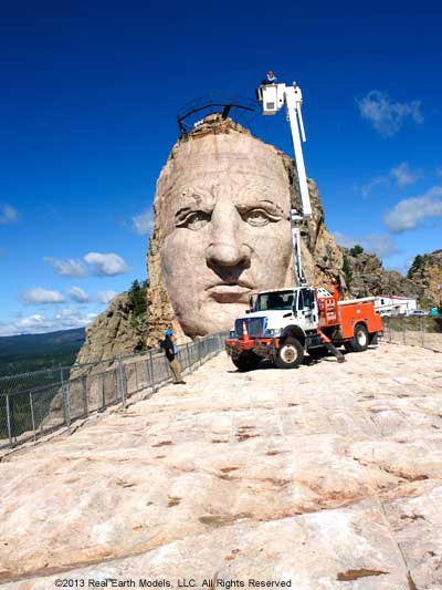
The unparalleled accuracy and limitless applications of REM’s innovative 3D PhotoReal™ technology has made us an industry leader in 3D modeling. We remain at the forefront of technology through our ongoing research and development in 3D virtual museums, staging for underground structures, and technology to improve quality and safety in the architecture, engineering, and construction (AEC) industry.
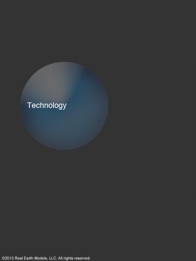
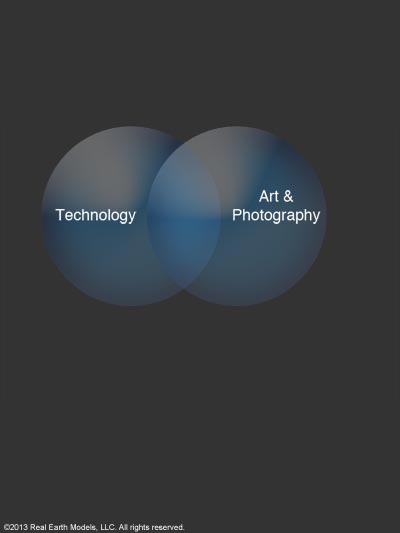
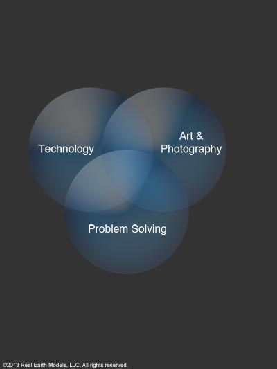
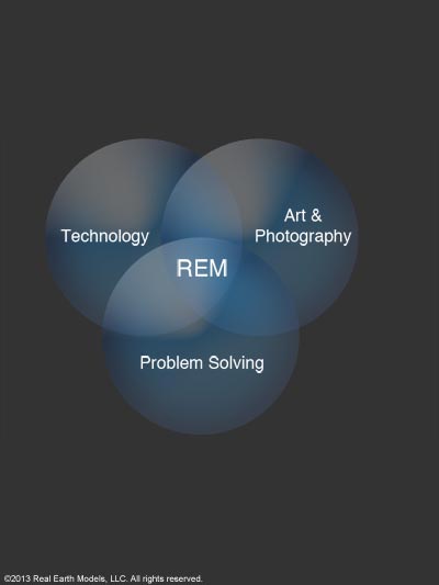
REM takes on challenges that are both significant and compelling. We endeavor to provide 3D visualization technology in capacities that advance positive development in society. Whether the project involves 3D laser scanning, mapping, modeling, or problem solving, our dedication and experience in 3D visualization technology produces clear, accurate solutions.
§ § §
At Real Earth Models we know that precise visualization data is often the missing link that is vital to problem solving. Our professionals are experienced in BIM (Building Information Modeling) technology, GPS (Global Positioning Systems), GIS (Geographical Information Systems), laser scanning, photography and database design.
With these disciplines, we use software programs appropriate for each project in developing accurate 3D virtual environment renderings and interactive systems. Software may include: Autodesk’s Revit, NavisWorks, and 3DS Max, Pixologic’s ZBrush, Foundry’s Mari, and Rhinoceros’s Rhino.
Our unique understanding of data comes with our uncommon depth of training in multiple fields. This understanding combined with our expertise and proprietary technology assures the highest level of accuracy in data illustration and visualization.
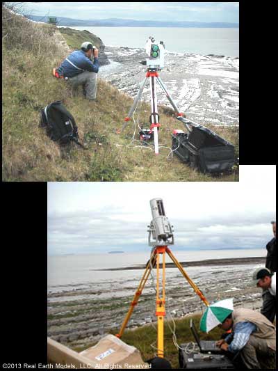
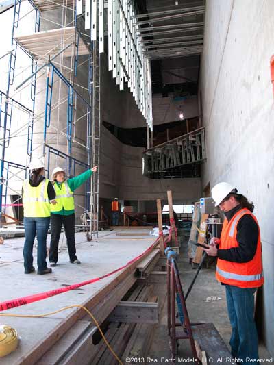
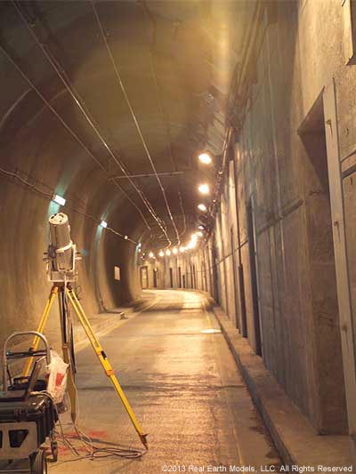
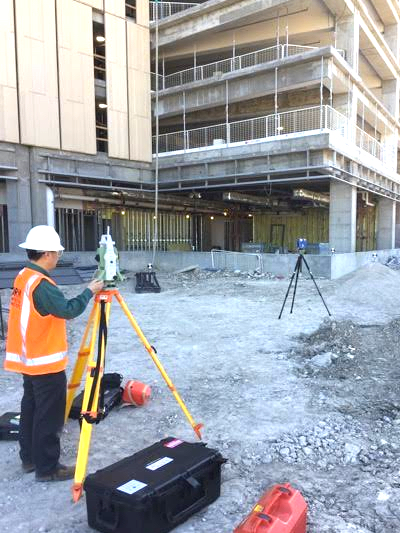
Our BIM team uses the latest laser scanning equipment to produce accurate scans that enable design teams to navigate and view the project from any angle. We provide the 3D models that give MEP and design professionals the precise documentation they need in just one site visit.
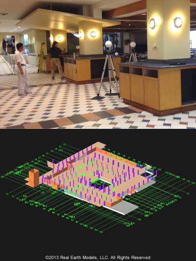
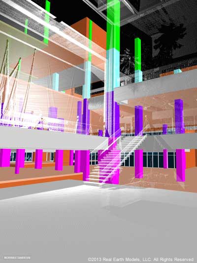
When technology is not adequate or available, our own proprietary 3D PhotoReal™ modeling technology brings additional resourceful solutions to the project. From laser-scanned data, we define surface features of a structure or terrain with absolute precision. We then deliver a visualization tool that reveals information with greater accuracy and detail than is currently available through any other scanning and processing method.
PhotoReal™ technology presents all details of texture and color in addition to accurate volume measurements. We enable the viewer to examine, analyze, zoom, rotate, and measure the uncompromised image data with greater ease, precision, and cost effectiveness. We also work with multiple types of data and we can position data derived from varying coordinate systems into one 3D PhotoReal™ model with one common coordinate system.
Our 3D PhotoReal™ Models, imported into lifelike virtual immersive visualization systems enable new collaborative applications and support decision-making. Immersive environments heighten interaction, allowing you to “be there” in real scale and share your data with your entire professional team. Virtual 3D field trips are a reality!
§ § §
Serving our clients is always our first priority. We understand our client’s high expectations and we strive to deliver the expertise and products that fulfill their vision and goals. We know that our continued success is driven by our dedicated service and by the quality relationship that we endeavor to build with each client.
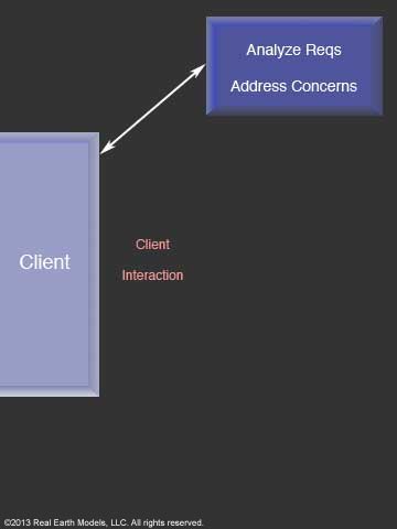
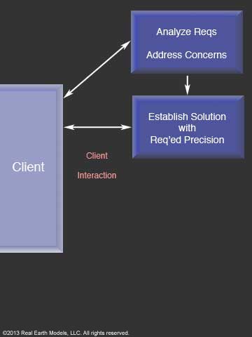
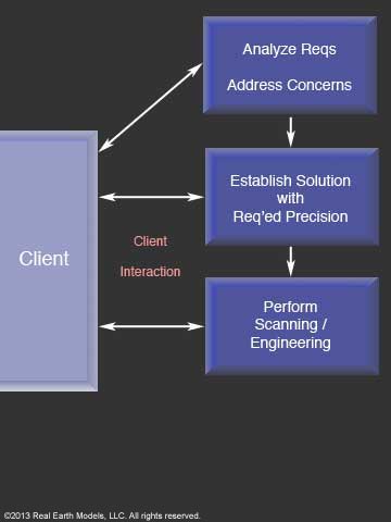
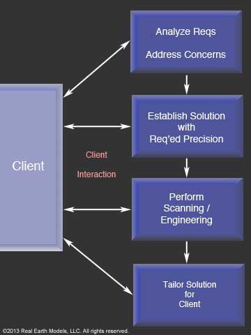
Understanding our client’s needs and responding to their concerns is crucial to establishing a good working relationship. We gain understanding through communication, and we begin by listening to the client. We then evaluate all facets of the project, address client concerns, establish a resourceful approach specific to the project challenge, and construct a comprehensive solution. Our dedication to delivering the highest-level precision in innovative visualization tools enables us to offer our client partners an innovative solution to their toughest problems.
Drawing from our depth of mastery in 3D laser technology, and our ability to employ a blend of technologies, we provide the insight, ideas, and tools that resolve challenges and satisfy our client’s most important goals. We strive for flawless delivery of service and products that consistently exceed client expectations. After successful project completion, we continue to stand by our clients, ensuring that they have the tools and service to make the goals set for tomorrow possible of attainment today.
§ § §
We …
- Are known among industry professionals for our ability to detect problems through our proprietary visualization technology and provide resourceful solutions where others have failed.
- Are a certified Women Business Enterprise (WBE) - a world-class certification, which is nationally accepted by thousands of major corporations and a select group of government entities.
- Achieve accuracy of 2 mm to 1 cm with our 3D PhotoReal™ Models.
- Uniquely process scanned data to show the image as it really is. A virtual exact replica of the original is created.
- Provide information that is at once qualitative and quantitative.
- Powerfully enhance the viewer’s ability to examine, analyze and rotate viewing angles of any 3D scanned structure or terrain with uncompromised integrity.
- Provide clash detection with superior analysis for effective inspection and documentation of interferences in a 3D project model.
- Are committed to service excellence and on-time project completion, at or below the proposed budget.
- Exemplify resourceful innovation in accomplishing each project.
- Support our clients following project completion.
§ § §
We are committed to a few core principles that are foundational to our daily operation. We believe that blending these principles in every facet of our work is vital to our success and to establishing respect among our clients and business partners in the global community.
- We are dedicated to serving each client with the highest standard of excellence while working to retain a cutting-edge in innovative technology that fosters progress in society. We maintain that integrity combined with innovation promotes better business and a better world.
- We strive to provide the best solution for each client that we are privileged to serve. We are uncompromising in our endeavor to help move projects from potentiality to successful achievement. We do this by remaining true to our values of honesty and diligence. Our aim is to consistently exceed client expectations in service and project completion standards.
- We strive to elevate communication through respect, trust, and reason in our approach to business. We strongly believe that communication is integral to project productivity, facilitating both progress and efficiency.
§ § §
Home | About | Consulting / Services | Portfolio | Site Map
web site ©copyright 2012 - 2025 Real Earth Models, LLC
Problems viewing this web site?
