Consulting/Services : 3D Laser Scanning


Transforming reality into a 3D virtual world is an efficient, timesaving alternative to conventional surveying that is increasingly applied in commercial and private enterprises. Real Earth Models™ provides specialized solutions to today’s challenges with the speed, convenience, and cost effective benefits of 3D laser scanning.
REM’s spatial data experts offer a variety of 3D laser scanning and digital mapping services. Our professionals understand data - both mathematically and artistically. We further combine our expertise in multiple disciplines with our knowledgeable use of laser scanning equipment to provide a sophisticated 3D visualization tool that improves project accuracy while reducing time and cost.
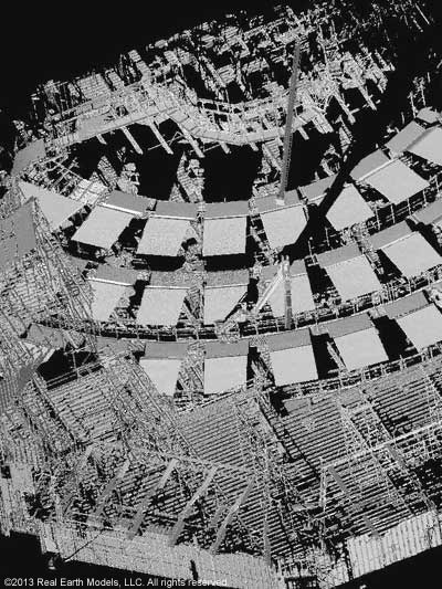
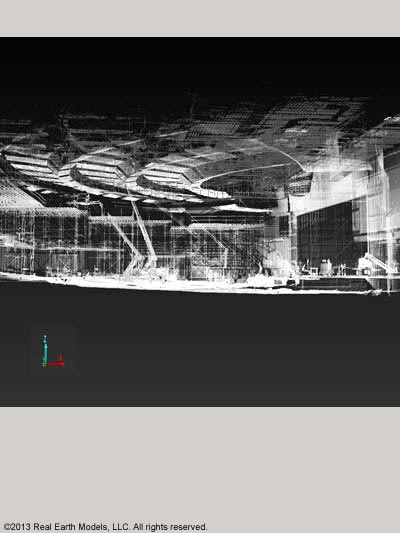
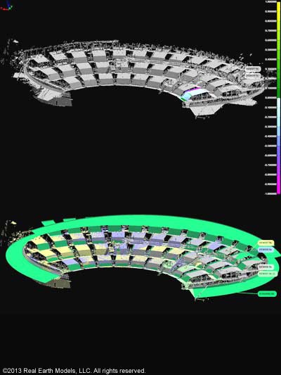
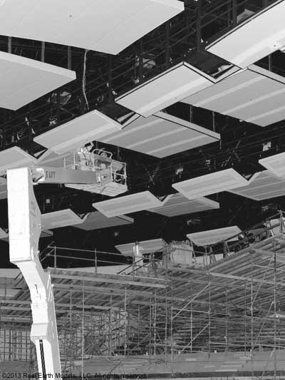
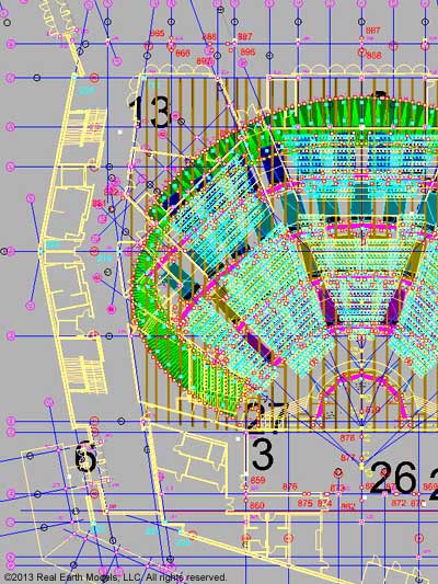
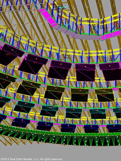
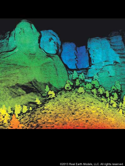
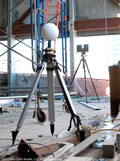
The need for accurate 3D documentation and reconstruction or 3D data analysis is the basis for many applications of 3D laser scanning. Our precise measuring and modeling captures data for analysis in topography, seismic surveys, erosion, and slope stability for Geological Studies. Laser scanning provides data and documentation for BIM and as-built construction, facilitating MEP teams, reducing clashes, enhancing measurement accuracy and supporting building operations. Our 3D laser scanning helps the Oil & Gas industry analyze and evaluate the potential for oil in promising locations. In the field of Historical Preservation, 3D laser scanning helps ensure accuracy and integrity of design in renovated structures. Laser scanning can also digitize and record the condition of buildings. Laser scanning, used in 3D Virtual Museums, documents and protects historical relics and antiquities from loss due to fire, flood, theft, or terrorism.
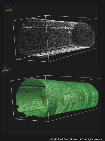
Our 3D laser scanning services precisely measure and digitize the terrain, structure, or object, accurately capturing 3D data of existing conditions. All facets of the project including location, actual color, and spatial elements are illustrated and documented.
§ § §
REM’s professionals are experts in expanding the virtual world to serve a diverse array of applications including:
- General topographic mapping
- Reverse engineering
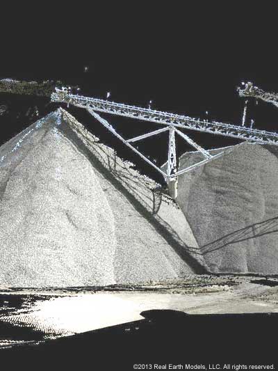
- Volumetric measurement (including underground)
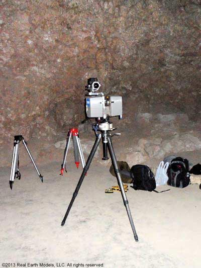
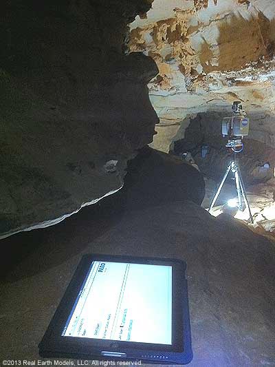
- Detail cliff face mapping (Highwall), geology and structures
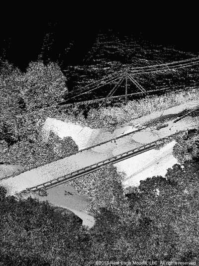
- Digital documentation of as built conditions (bridges, industrial factories, monuments and endangered heritage sites)
- Change detections (deformation monitoring, slope stability)
- Rapid pre and post-blast surveys
- Where personnel accessibility or safety prohibits conventional surveying
- Geology and soil science
- Transportation
- Law enforcement
- Animation and virtual reality applications
We offer solutions in many other applications. Contact us to find out how our solutions in 3D laser scanning and modeling can benefit you.
§ § §
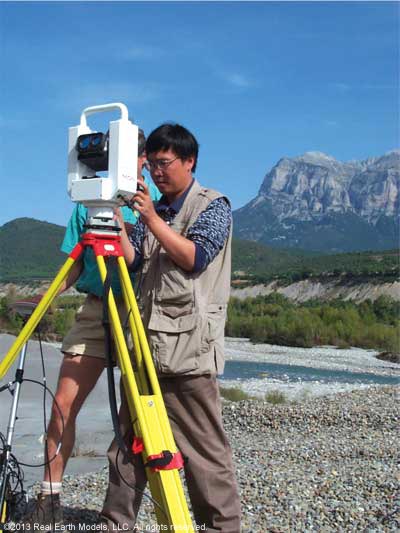
Fast laser scanners facilitate high definition field data capture, and can be used even in complex environments to create a virtual copy of the real subject within minutes. Digitizing and documenting information is critical in many industries. Our engineering team evaluates each project’s scope, location, and other requirements to determine the appropriate equipment to effectively meet the project’s comprehensive objective. REM uses several types of laser scanners including long-range time of flight and medium range phase-based scanners.
For precise measurement and 3D documentation, we use time of flight laser scanners from Faro for applications such as reverse engineering, as-built documentation, and asset management. We also use Riegl’s 3D LiDAR- advanced time of flight scanner in topographic mapping, mining, as-built construction, geological outcrops, seismic surveys, 3D architectural engineering including BIM, geo-referencing, and historical preservation.
REM uses other types of fast laser scanners including medium-range phase based precision scanners, such as the Surphaser 3D scanner for digitizing and documentation in 3D architectural modeling, historical preservation, and reverse engineering.
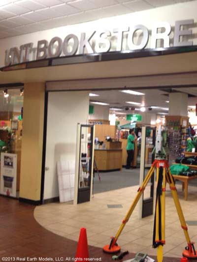
We also use surveyor-grade Leica total stations, providing additional controls for laser scanning projects when needed.
§ § §
Home | About | Consulting / Services | Portfolio | Site Map
web site ©copyright 2012 - 2025 Real Earth Models, LLC
Problems viewing this web site?
