Consulting/Services : GIS / GPS Mapping & Database Design


REM offers a variety of spatial data services that deliver accurate, rapid solutions for numerous industries. Dedicated professionals at REM have nearly 2 decades of experience working in the field of GIS and GPS mapping. Our expert team and staff have multi-disciplinary backgrounds that include GIS/GPS applications, digital mapping, laser-scanning technology, and 3D mapping and modeling. Our broad technical background enables us to serve clients whose need may extend outside the scope of GIS/GPS or database design into other disciplines. Our clients receive full service, customized for their needs.
REM’s database design solutions organize textural and geographic information in one database to enable specific searches, tailored for the client. We work with clients in designing database solutions that optimize information into a form that is organized and easily implemented. We also help clients integrate data into third party software.
§ § §
REM incorporates GIS as part of the BIM (Building Information Modeling) strategy in construction. We combine the strengths of these two worlds to enhance communication and visualization through 3D models in GIS.
REM’s GIS services help improve construction planning and design efficiency by solving engineering and construction problems related to the use of spatial data. Our GIS solutions provide greater visualization, integrate information, and facilitate data creation and management. Linking spatial and scheduling information together through GPS improves real time schedule monitoring, construction processes, and efficiency.
REM’s GIS solutions facilitate the organized information flow between the construction, engineering, and design disciplines in a project to ensure that drawings, 3D components, scheduling, cost estimates, and specifications are synchronized to each other. This integration of project management functions, together with the visualization element of a spatial database, provides an effective management control system.
§ § §
Nearly every decision made in the petroleum industry is based on spatial information of the Earth’s surface and subsurface. Where to find reservoirs, where to drill wells, where to route transportation such as pipelines, or where to build refineries, are considerations requiring a thorough understanding of the correlation of petroleum-related products to the surrounding geography.
REM’s expertise in GIS services helps companies manage the spatial components of petroleum business property such as wellhead locations, tank batteries, gas gathering systems, pipelines, processing and transport facilities, environmental elements, and retail outlets. REM designs databases that facilitate data organization and appropriate geographic analysis.
REM’s 2D and 3D GIS services help evaluate the potential for oil in promising locations. Exploration is a complex process that requires the analysis of many different types of data, such as satellite imagery pertaining to topography, digital aerial photo mosaics of tectonic appearance, seismic surveys, structural and sedimentary geology studies, subsurface and cross section interpretations and images, electro-magnetic well logging, and existing infrastructure information. Applying skill and knowledge of GIS and GPS technology, REM effectively ties these disparate data together at the location in question.
In combination with conventional GIS/GPS services, REM’s technical personnel can overlay, view, and manipulate the data in the form of 3D models and maps enabling analysts to thoroughly investigate the prospective for finding new or extending existing potentials. Discovering new sources of petroleum ahead of the competition is key to success in the petroleum industry. REM’s strength in GIS/GPS services combined with our 3D PhotoReal™ modeling, gives the petroleum industry the GIS solutions to vastly improve exploration.
To produce oil from explored reservoirs, companies must first obtain specific first-hand data about the area in question, including geography, infrastructure, business conditions, and environmental factors. GIS technology is ideally suited to this kind of overlay analysis and REM can design databases to efficiently organize this information. When integrated with other business risk or economic planning engines, REM’s database design services and GIS technology can complete a focused business solution tool set.
Reservoir characterization is the analysis of detailed data sets of surface exposures of rocks that are similar to those which form the buried reservoirs for petroleum. The goal of the reservoir characterization process is to allow the engineer to extract the petroleum more efficiently.
REM is able to develop virtual libraries by constructing 3D PhotoReal™ Models of core samples and organizing the information into an easily accessible database. A 3D PhotoReal™ Model of a core sample is an exact replica of the actual core sample. A PhotoReal™ core sample accurately provides all of the data, measurements, and properties required for analysis by geologists, engineers, and drillers. A digital core sample produced with REM’s PhotoReal™ technology is cost efficient, is easily stored, and is immediately delivered anywhere, anytime.
Coring is an important source of data used by oil companies, research labs, and universities to better understand and analyze oil and gas reservoirs and potential productivity. Information obtained from core samples drives insight leading to cost-efficient and energy saving techniques that benefit producers and consumers in petroleum production.
§ § §
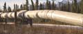
Accurate geographical information is required for successful planning, operation, and maintenance of pipelines. REM’s services in GIS/GPS technology make acquisition, processing, and delivery of geographic information more efficient, more accurate, and more effective.
Our exceptional accuracy in mapping surface features, and in detecting and measuring changes, supplies the information pipeline designers and managers need for safe construction and management. REM’s GIS services provide the pipeline operator with improved capability to manage pipeline integrity, improved efficiencies in pipeline operations, and improved response to business development opportunities.
GIS-based risk evaluation provides a comprehensive, systematic method for building and maintaining comprehensive pipeline risk models. GIS technology, combined with our proprietary techniques support risk mitigation, emergency response, remediation, reporting, and investigation.
REM’s GIS services provide the data integration capabilities, modeling tools, analytical functionality, and a visualized reporting environment necessary to build and maintain comprehensive pipeline risk models. The data provided can reliably attribute risk to sections of a pipeline for prioritizing upgrade and maintenance schedules.
Optimal planning of a pipeline development project requires integration of the geographic information governing the engineering, environmental, and socioeconomic costs. REM delivers the GIS services for data management and analysis, which provides the most effective method for defining these complex geographical relationships and for computing optimal solutions to these multivariate problems.
REM delivers 2‑D and 3‑D GIS and GPS services for pipeline construction designed to perform numerous tasks including:
- Assisting surveyors in making route adjustments to minimize impact on sensitive or problem areas.
- Identifying areas prone to forest fire or soil erosion.
- Capturing and managing data collected by survey crews or construction personnel regarding potential or actual construction problems, sensitive soils, wildlife habitat, and heritage sites.
- Locating optimum access roads, staging and fueling locations, work camps.
- Capturing essential information on construction materials and equipment. For example, each weld can be precisely located using GPS.
§ § §
Detailed information, safety, and efficiency are critical concerns in the mining industry. The threat of collapse in underground coal mines is a constant danger to mine workers. In addition, mining companies may avoid re-opening previously closed mines because of the risk levels determined using existing technology. This may leave immense resources to waste below ground. More precise geographic measurement of the mines and surrounding terrain can provide more accurate risk assessments for both currently operating and closed mines. The process involves measuring with GPS/laser scanners the position of the Earth and its change over time, combined with images from digital cameras providing the detailed information—but precisely mapped and modeled in three dimensions.
GIS technologies can also help to fundamentally improve planning and operation in the surface mining industry. REM’s laser scanning combined with 3‑D modeling techniques record the geometric, texture and lithologic information of a mine and the environs. These data can increase the management team’s ability to evaluate the production process and to optimize future exploration and associated blasting and tunneling procedures. The management team can also more accurately assess the rate of removal of material and estimate the below ground reserves when combined with REM’s proprietary 3‑D PhotoReal™ modeling processes. This planning and evaluation technique is possible for both open pit and underground mining.
§ § §
Geography plays an important role in public safety, law enforcement, and criminal justice. Response capabilities often rely on a variety of data from multiple agencies and multiple sources. REM’s GIS services facilitate organized processing of spatial information so that appropriate agencies can respond to public safety issues quickly and effectively. Our GIS services enable efficient allocation of emergency resources to affected areas or trouble spots. REM’s accuracy in georeferencing provides mission-critical information about the location of a crime, incident, suspect, or victim that is often crucial to determining the manner and size of the response.
REM delivers GIS/GPS services that allow law enforcement, criminal justice, and other emergency response personnel to plan effectively for emergency response, determine mitigation priorities, analyze historical events, and predict future events. Our GIS solutions also assist in tactical planning and response by providing accurate critical information to emergency responders upon dispatch or while en route to an incident.
Unfortunately, criminal action may occur in any location, at any elevation, and emergencies may take place above and below ground level. By combining REM’s GIS services and our advanced laser scanning technology and state-of-the-art 3‑D modeling techniques with other data including satellite imagery, remote sensing and aero-mapping data, REM is capable of constructing a true 3‑D Virtual Street, Virtual District, and Virtual City databases. REM’s GIS solutions and advanced technology supply tools that improve emergency response, development planning, and other governmental and societal needs.
§ § §
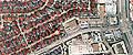
REM implements GIS-based solutions in all segments of the real estate industry. From map-based contact management to sophisticated investment analysis in large Real Estate Investment Trusts, to creation of promotion-related Virtual Subdivisions or Virtual Building Complexes.
GIS allows the realtor to integrate a wide variety of data into the common format of a map. Widely varying data that affects the desirability and property value can be presented on one or two maps. The property's suitability as a first time residence, portfolio acquisition, or retail site, can be viewed more accurately than any number of generalized market studies, photographs, or marketing text.
GIS technology combined with REM’s unique modeling technique, allows developers to broadcast 3D tours of their properties, from inside out, via the Internet, or through displays in their agent’s offices.
§ § §
Forest management has become an increasingly complex and demanding challenge. Plans, resource considerations, and business decisions are often made in an atmosphere of conflicting values and with considerable uncertainty.
REM’s GIS solutions and 3‑D mapping provide greater accuracy in measuring terrain changes, growth rates, and timber crop density. Improved processing, analysis, and presentation of GIS data can provide foresters and natural resource managers with powerful tools for better analysis and decision-making. REM’s GIS solutions provide an overall picture of the resources under management allowing more accurate choices of harvesting options. Improved GIS information also increases the accuracy of long-term supply strategies and stock forecasting. In combination with GIS technology, REM has the unique capability to perform detailed (to sub-centimeter) accuracy and resolution remote sensing on the ground, at close range (meter to kilometer). The results are similar to classic photogrammetry but acquired more efficiently and economically. This close-in mapping allows remote sensing activities at a detail and accuracy heretofore almost unknown.
§ § §
Home | About | Consulting / Services | Portfolio | Site Map
web site ©copyright 2012 - 2025 Real Earth Models, LLC
Problems viewing this web site?
