Portfolio : Oil & Gas


Bottom Image: 3D PhotoReal™ Model
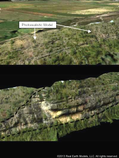
Real Earth Models created a 3D, PhotoReal™ Model of ExxonMobil’s Jurassic Morrison Formation at the Lake Powell area of southern Utah. PhotoReal™ technology enhanced the data acquisition for this unique outcrop comprised of complex topography. The 3D PhotoReal™ Model captured detailed features of this outcrop and provided an exact likeness of the terrain. The model was created to enhance visualization capabilities and extend research and analytical processes for the project.
REM has the capability to produce 3D, PhotoReal™ Models using third party or client-supplied data and photographs. ExxonMobil’s Utah project presented this possibility. We evaluated a sample data set from part of a scan along with appropriate images provided by ExxonMobil. We checked the point scan and photographs to determine the quality of the proposed PhotoReal™ Model. This test also served to determine the level and extent of problems that may exist, and to demonstrate the quality of the 3D model that can be produced with the client-supplied data and photographs. Testing supported the quality of the supplied data and photographs, which proved suitable for producing an accurate model.
PhotoReal™ modeling technology made possible the examination and analysis of features of the Utah outcrop from any perspective, anywhere, anytime. Visualization and research capabilities for the client's project expanded.
§ § §
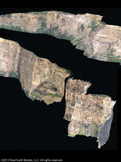
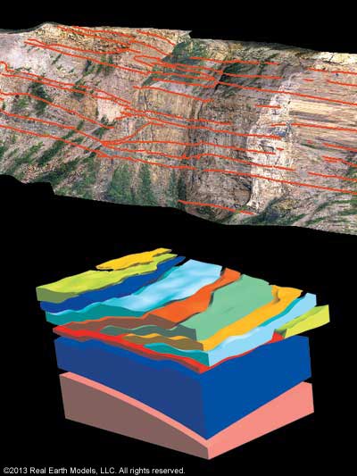
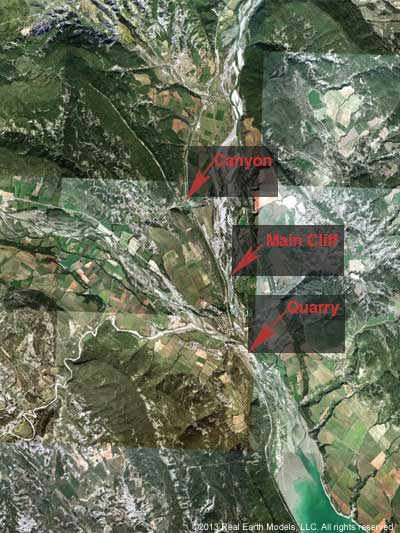
Increasing the accuracy of hydrocarbon fluid flow calculations and projections depends essentially on improved understanding of data collected from outcrop analogs. Norsk Hydro looked to REM for 3D PhotoReal™ modeling technology to enrich their data collection and provide enhanced understanding of the distribution of key architectural elements and spatial variability of an outcrop in the Spanish Pyrenees. Patterns in the outcrop mimic fluid flow in subsurface reservoirs. Traditional field methods for obtaining and interpreting data lacked precision, leading to uncertainty in drilling operations. REM’s PhotoReal™ Model provided a rich source of accurate data critical for understanding the region’s geological complexity. The PhotoReal™ Model also enabled integrated analysis with other surface and subsurface data to better understand and appraise deep-water reservoirs in the North Sea, the heart of much of Norsk Hydro’s petroleum activities.
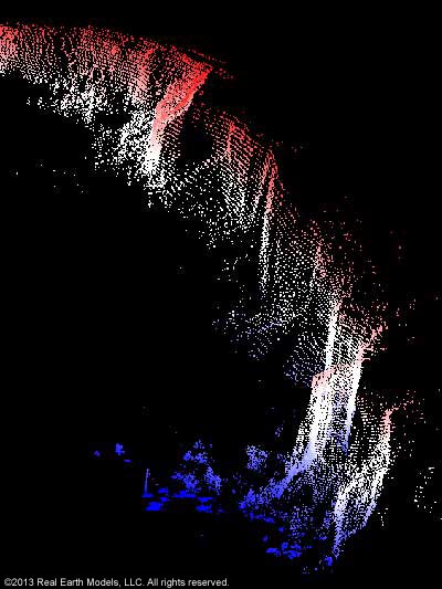
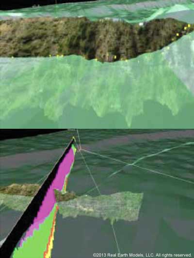
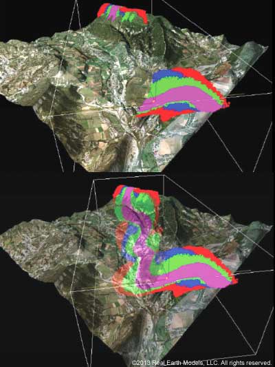
In producing the PhotoReal™ Model, aerial photography, using a lens calibrated to coordinate with the point cloud, defined the regional stratigraphic framework. Ground-based LiDAR acquisition digitally mapped the geometry of the outcrop in centimeter accuracy. The 2D photographic image was then overlaid onto the 3D geometry of the outcrop. REM’s proprietary processing methods created a uniquely precise 3D PhotoReal™ Model. This advanced technology allowed analysis of sedimentology and stratigraphy of the outcrop to be measured and interpreted with precision. Information gained from REM’s cutting-edge, 3D PhotoReal™ modeling technology, potentially increases the accuracy of hydrocarbon fluid flow calculations by approximately 60 percent. Improved fluid flow calculations helped Norsk Hydro assess oil field accommodation for additional wells.
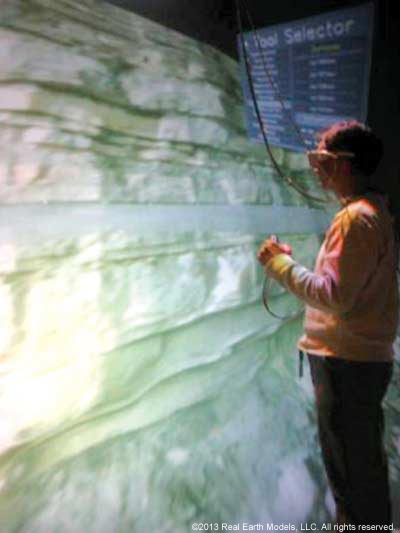
In this project, REM’s technology made possible the investigation of width thickness and length ratios of various stratigraphic zones in addition to assessment of fracture patterns and faulting. Also possible was accommodation for the corporation’s entire team of geoscientists to study the outcrop captured in 3D PhotoReal™ through wide screen projection from a corporate office. Additionally, data enhancements enabled Norsk Hydro geoscientists to analyze and compare differences between a 3D outcrop model and seismic data. By superimposing the outcrop data captured in the PhotoReal™ Model over seismic data, and comparing a drilling report, accurate drilling pressure assessments were possible, thus helping ensure integrity of the well bore.
§ § §
Home | About | Consulting / Services | Portfolio | Site Map
web site ©copyright 2012 - 2025 Real Earth Models, LLC
Problems viewing this web site?
