Portfolio : Problem Solving


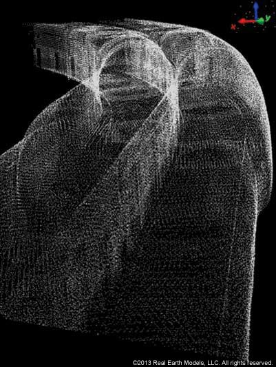
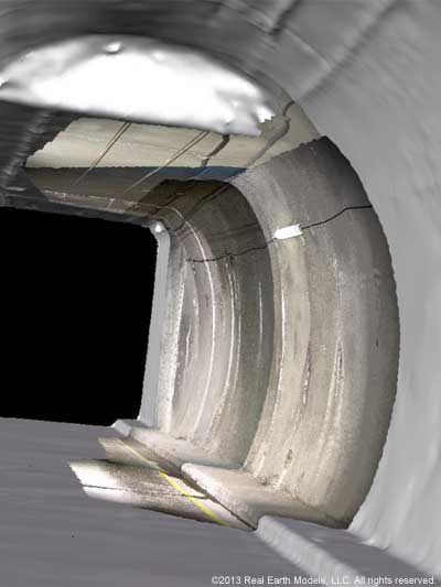
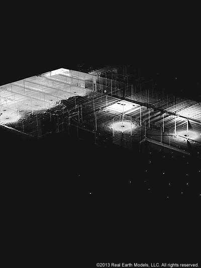
Bottom: Color point cloud
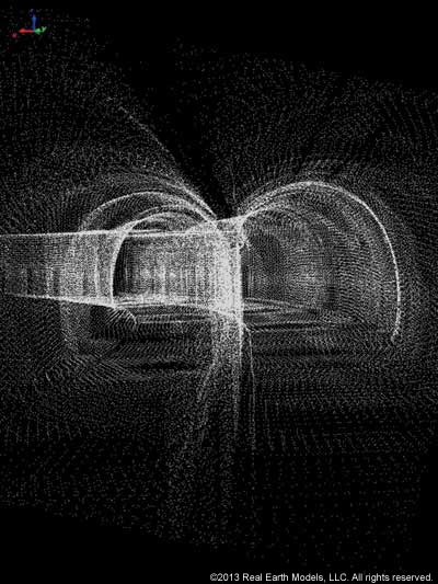
Bottom: Color point cloud
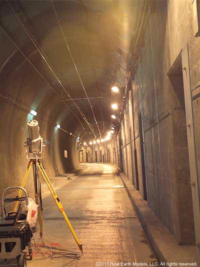
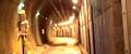
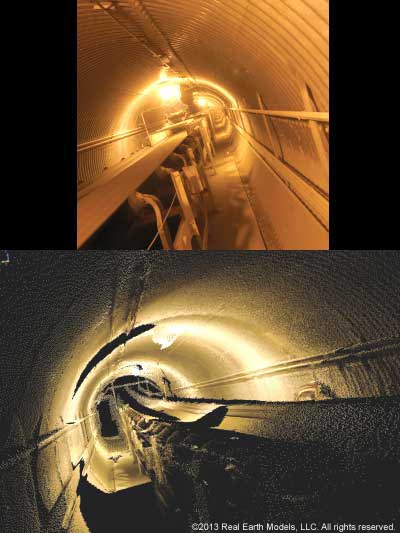
Silver Line Dual Tunnels
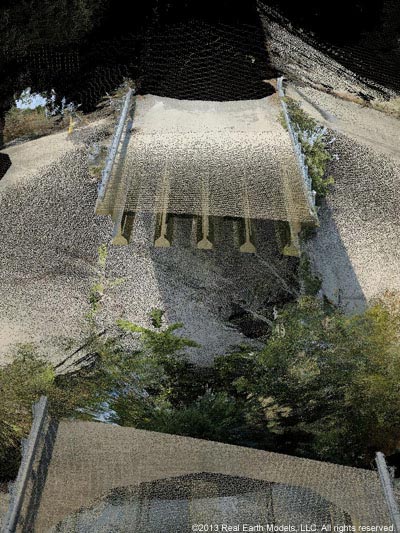
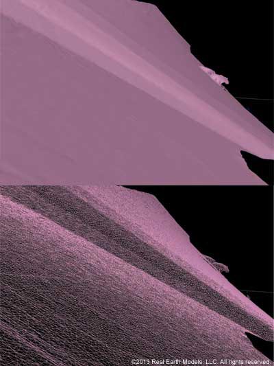
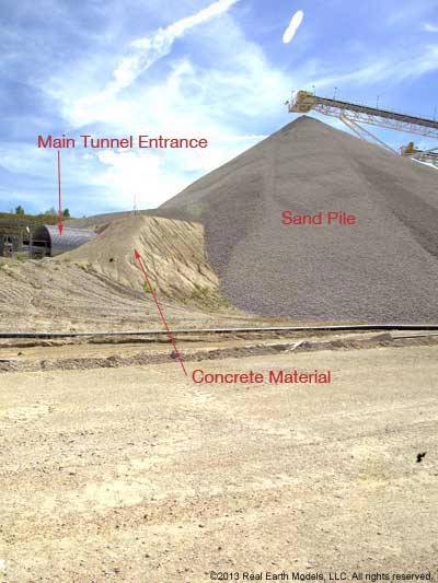
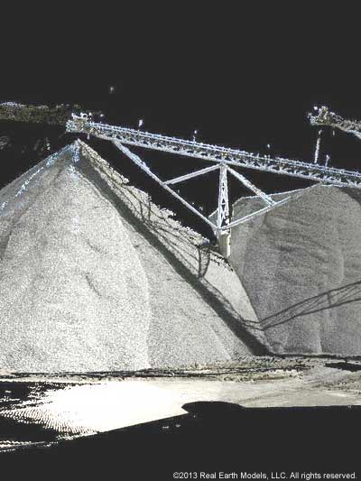
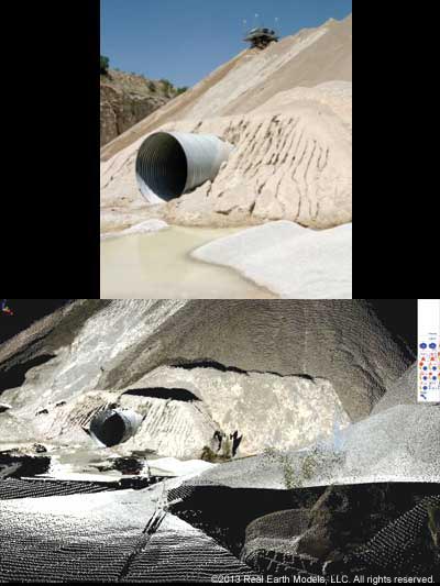
Hanson Aggregates South Central is one of the leading aggregate producers in the United States operating numerous crushed stone quarries and gravel operations. The Lake Bridgeport plant of Hanson is a limestone quarry maintaining several stockpiles of crushed limestone. Inventories are typically calculated using aerial photogrammetry to measure stockpile volume. One massive stockpile posed a challenge in measurement because a large concrete tunnel, housing a conveyor belt, traversed the base of the stockpile.
Hanson needed an accurate volume measurement for the massive stockpile, but traditional aerial measurement methods could not account for the negative space of the stockpile’s large tunnel. Hanson turned to REM to solve the problem of accurately measuring the volume of the stockpile. With the use of oblique LiDAR, REM scanned, mapped and modeled the inside of the tunnel and accurately calculated the volume of the tunnel. A precise volume measurement for the stockpile was achieved by subtracting the volume of the tunnel from the volume of the stockpile.
§ § §
The Massachusetts Bay Transit Authority (MBTA) operates most of the subway, bus, rail, and ferry routes in the greater Boston area. The MBTA subway is one of the busiest subway systems in the United States. Shortly after a new section of the MBTA’s Silver Line tunnel was operational, permission was requested for the construction of a 10-story parking garage over a portion of the new tunnel. The structure of the tunnel was modified and strengthened to accommodate the weight of the parking garage.
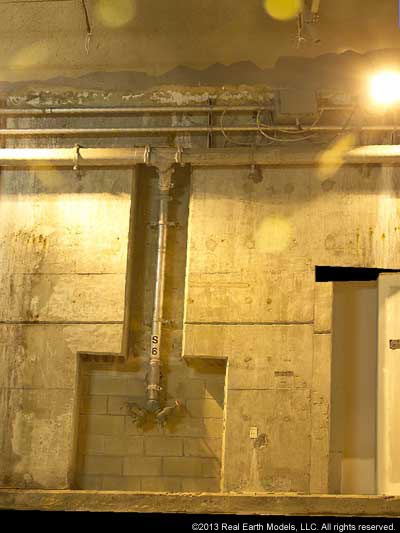
REM was called in to perform scanning and 3D PhotoReal™ modeling services to help monitor and analyze the structural integrity of the section of tunnel below the parking garage. REM’s PhotoReal™ Model documented the base measurements of the tunnel and accurately recorded the tunnel’s exact likeness at that moment in time. Subsequent scanning / modeling would reveal signs of fatigue or structural changes in the tunnel that might occur due to the weight of the parking garage. Any developing deformation is readily detected by a change in shape and/or a change in color, so that appropriate action can be taken. The amount of change, if any, would determine responsibility for repairs to the tunnel.
Our exclusive method of integrating laser-scanned data with color photography creates an accurate 3D PhotoReal™ Model, which can document any surface or terrain, and is especially effective for monitoring tunnels or bridges where accurate documentation of surface shape and color are critical. REM’s PhotoReal™ modeling technology provides the continuous or qualitative data necessary to reveal the exact location and the extent of any leak or crack.
§ § §
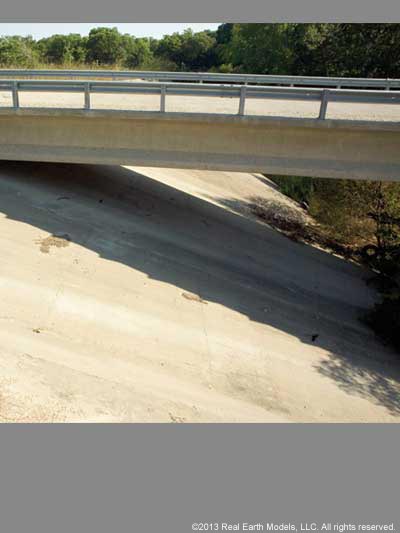
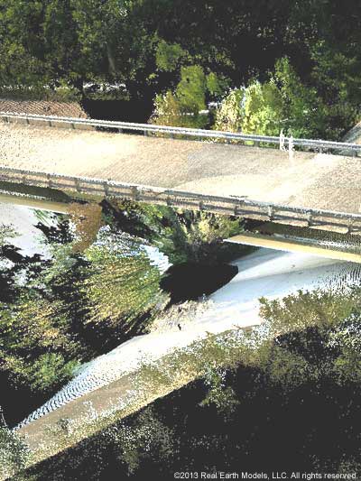
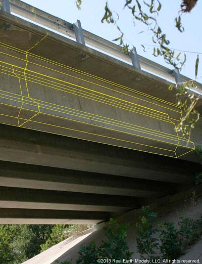
REM’s PhotoReal™ modeling technology provided solutions for improving emergency floodwater protection for the North Texas city of McKinney. Facing considerable population growth in recent years, McKinney is one of several communities north of Dallas to initiate projects designed to improve floodwater control protection. As a significant part of urban growth in this area, flood protection remains an important concern in protecting lives, infrastructure, and economic development in McKinney.
For this project, flood control preparation required calculations of how much water could be released from a dam to protect against flooding the nearby bridge or straining the bridge’s structural supports. REM was asked to scan the bridge and embankment for volume analysis in determining the amount of water that could be safely released from the dam following high rainfall. Water discharged at too great a volume or pressure could result not only in erosion, but breech of the structure as well. REM’s precision 3D laser scanning provided accurate volume calculations, which included laser scanning measurements of the bridge height, and the angle and width of the embankment.
§ § §
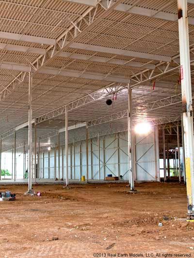
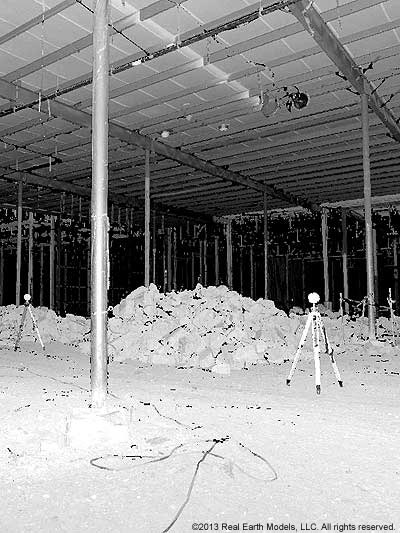
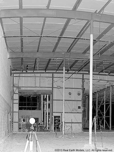
White Wave Foods, a division of the prominent dairy company, Dean Foods, produces and sells a variety of nationally branded soy, dairy and dairy-related products. A planned renovation and expansion project involved gutting a long-standing factory building down to its structure. White Wave called on REM to laser-scan the building’s interior space. In keeping with White Wave’s sustainability commitments, preserving the building’s original steel columns and beams was a goal in the renovation and expansion plan.
During processing of the laser scanned columns, cross-sections of data revealed that some of the columns had warped and were incapable of supporting the weight of the proposed roof design. This evidence of deformation under stress was not visible to the eye. Advanced techniques in laser scanning, combined with application of BIM tools, and other scientific methods utilized in processing, provided vital information on the building’s structure. REM delivered an accurate BIM model with additional scientific data illustrating the status of the columns. The BIM model could be viewed quickly, clearly and in 3D. BIM, and additional data, enabled structural engineers to identify which columns in the supporting structure had maintained the integrity to support the weight the new roof design, and which columns showed evidence of failure.
§ § §
Home | About | Consulting / Services | Portfolio | Site Map
web site ©copyright 2012 - 2025 Real Earth Models, LLC
Problems viewing this web site?
